
Free
Satellite imagery£0
any farm size
Watch all your fields from home. Free forever.
- Satellite view of your fields
- See which field to harvest first
Smart aerial crop analysis from drone and satellite data. Save up to 70% on chemical with AI-generated variable rate prescription maps for any brand of sprayer.
CultiWise enabling Smart and Sustainable farming with data driven AI prescription maps for any brand
CultiWise is an easy-to-use software platform which allows the creation of prescription maps for spot spray and variable rate application based on drone or satellite data.
The data is processed through CultiWise system. Where weed maps and variable rate maps are created using AI models. These maps are then uploaded into the tractor or sprayer where the prescription can be applied.
Tallis Amos Group is an authorised dealer of CultiWise in the UK and can help set up and support you using CultiWise. Flexible image sources make it ideally suited to the UK climate where cloud cover can affect satellite imagery.
 Tallis Amos Group is the authorised CultiWise dealer for the UK.
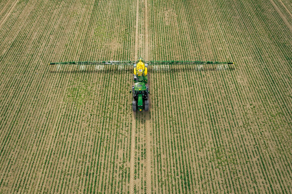
The savings stack up for your inputs, your soil and the environment.
Drone imagery for detail on demand, satellite data across the whole farm.
Autonomously-flown drones capture detailed multispectral data ready for CultiWise AI to turn into actionable prescription maps.
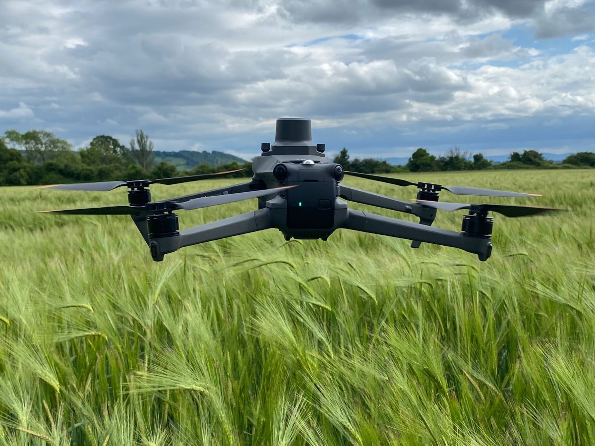
Cloudy UK skies? No problem. CultiWise blends drone and satellite imagery so the prescription maps keep flowing whatever the weather.
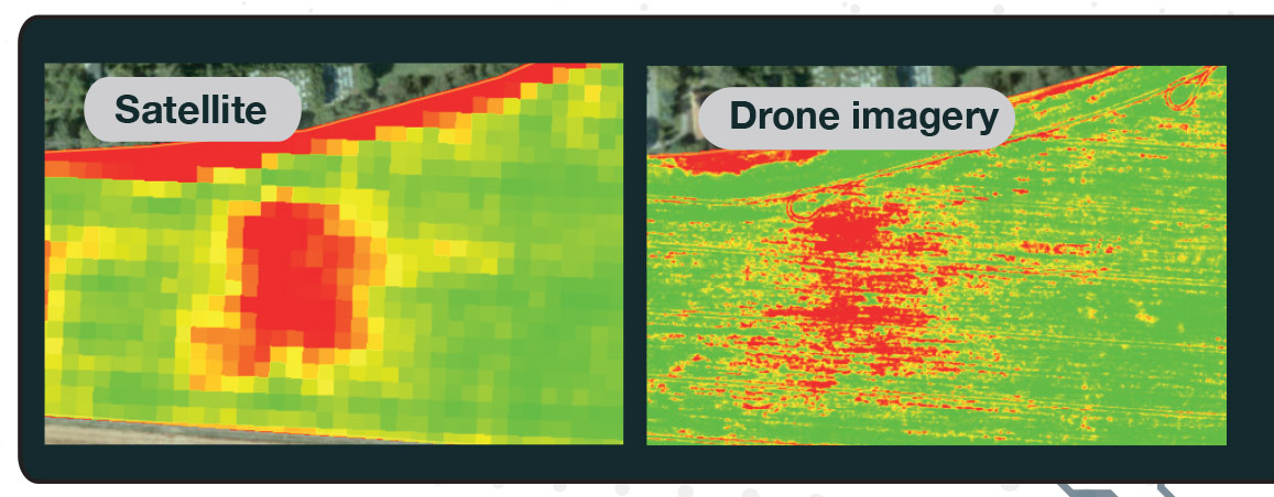
From aerial capture through to application:
Planning drone flight using the CultiWise Mission Planning feature at CultiWise.com
Capturing high-resolution imagery of the field using a drone following the CultiWise Mission Plan
The high resolution imagery is uploaded to CultiWise, processed and stitched together.
CultiWise AI analysis the imagery identifying weed species, crop stress and growth variation across every hectare.
A field-specific variable-rate or spot-spray map is generated, with total product volumes calculated before you set off.
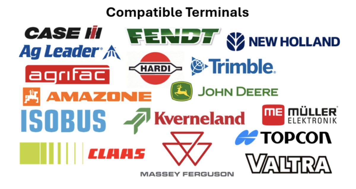
The map drops straight into the tractor or sprayer terminal. Compatible with John Deere, Case, New Holland, Fendt and more.
Apply chemistry, fertiliser or seed only where it’s needed using section control or nozzle-by-nozzle precision spot spraying delivering precise application.
CultiWise AI models trained for UK fields, UK weeds and UK weather.
Detect emerged weeds against bare ground after harvest or before establishment. The easiest win for spot spraying with the biggest chemical savings.
The hardest detection job: identifying weed species against a growing crop. CultiWise AI models are trained specifically on UK conditions and species.
Beyond spot spraying. CultiWise builds variable rate maps for the whole input plan, drawn from current and historical imagery.
For row crops, the Zoneye AI counts individual plants across the field, quantifying establishment and forecasting yield long before harvest.
CultiWise prescription maps drop straight into the in-cab terminals on tractors and sprayers from every major manufacturer.
Unlimited yearly plans for your whole farm. Pick your farm size to see the price.
£0
any farm size
Watch all your fields from home. Free forever.
£170 / year
for a farm up to 100 ha
Variable rate from satellite. No drone needed.
£850 / year
for a farm up to 100 ha
VRA maps from satellite and drone images, plus targeted burndown.
£1,190 / year
for a farm up to 100 ha
Everything, including spot spraying in the growing crop and stand analysis.
£0
any farm size
Watch all your fields from home. Free forever.
£340 / year
for a farm up to 250 ha
Variable rate from satellite. No drone needed.
£1,280 / year
for a farm up to 250 ha
VRA maps from satellite and drone images, plus targeted burndown.
£1,790 / year
for a farm up to 250 ha
Everything, including spot spraying in the growing crop and stand analysis.
£0
any farm size
Watch all your fields from home. Free forever.
£505 / year
for a farm up to 600 ha
Variable rate from satellite. No drone needed.
£2,140 / year
for a farm up to 600 ha
VRA maps from satellite and drone images, plus targeted burndown.
£2,990 / year
for a farm up to 600 ha
Everything, including spot spraying in the growing crop and stand analysis.
£0
any farm size
Watch all your fields from home. Free forever.
£850 / year
for a farm up to 2,000 ha
Variable rate from satellite. No drone needed.
£2,990 / year
for a farm up to 2,000 ha
VRA maps from satellite and drone images, plus targeted burndown.
£3,850 / year
for a farm up to 2,000 ha
Everything, including spot spraying in the growing crop and stand analysis.
Start works from satellite imagery. Plus and Pro also use your drone images.
Contractors pay as you go: £4.50 per hectare per upload. Farming more than 2,000 ha? Talk to us about a plan.
No. CultiWise works with satellite imagery as well as drone data, and TAG TECH can give a demo of your fields for to see higher-resolution drone imagery. You can also purchase a compatible drone (e.g. DJI Mavic 3 Multispectral) directly through TAG.
Almost certainly. CultiWise exports prescription maps in formats compatible with every major in-cab terminal: John Deere, Case IH, New Holland, Fendt, Massey Ferguson and more. From 5m boom section control right down to individual-nozzle precision, we have you covered.
Independent case studies have shown up to 70% reduction on contact herbicides when spot-spraying weeds versus blanket application. Actual savings depend on weed pressure and field. Most growers see meaningful savings in their first season.
Cloud cover is the limiting factor for satellite imagery, CultiWise can use satellite imagery to produce variable rate maps, however where timing is critical, drone flights give you imagery on demand.
Yes. That’s the whole reason TAG is an authorised UK dealer. The TAG TECH team will help with onboarding, drone flight planning, prescription-map workflow and in-cab compatibility setup. Call 07507 671287 or email cultiwise@tallisamos.co.uk.
References
Claim your free 15 hectares, see what CultiWise can map for your farm and start saving on your inputs this season.
Authorised UK CultiWise dealer · AI prescription maps · Brand-agnostic · TAG Tech setup & support